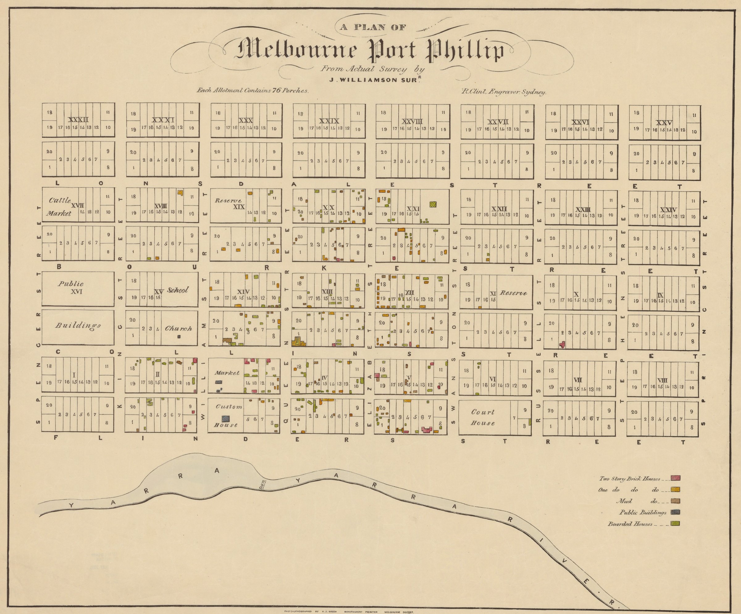
A plan of Melbourne Port Phillip
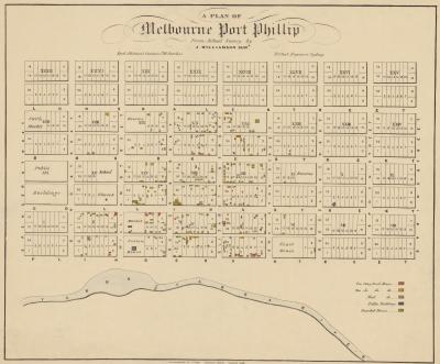
Map of central Melbourne showing location of brick houses, mud buildings, public buildings and boarded houses.
J. Williamson, c. 1839, map.
Accession number: MAPS LB 821.02 A [1839] WILLIAMSON
From the State Library of Victoria Maps Collection.

