Exploration - Making maps
Learning intention
Students begin to explore why the great journeys of explorations took place. They take on the role of explorers to investigate and document key features in their local environment. Students collect and record data to develop their own maps.
Students will:
- Pose a range of questions about the past
- Locate relevant information from sources provided
As they work towards AusVELS Humanities - Geography, Level 5, students collect, record and describe data obtained through field study surveys and measurements and develop increasingly sophisticated map skills enabling them to visualise and describe location and direction using grids and compass points.
Resources
- State Library Victoria Map collection or access to hard copy maps and atlases
- If exploring suburbs of Melbourne, the Old Melbourne street directories digitised collection includes suburban maps from 1912-1952
- Student access to cameras or personal devices that take pictures
- A local area to map - eg. school, local park, town centre
- Paper and pencil to create maps
Activity
Ask students to consider the big question: why do people explore? Many early explorers went on their journeys to look for new places to settle either for themselves or others. They would look for resources to meet people's needs such as water, food sources, good land and timber. The maps and drawings they created on their travels provided valuable information for those who followed.
Discuss personal adventures. Have you ever been exploring/on an adventure? Where did you go? Why did you go? What did you find? Normally when you go somewhere new, there are so many things to see and do. How do you remember everything you've seen and done? What could you do to help remember better? (Record it. Use photos, notes, drawings, maps. Includes what and where things are.)
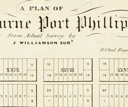
Ask students to look at a range of different maps. These could include historical maps such as those in the State Library Victoria's map collection or maps in books, on paper or online. Ask students to begin to identify the different markings on maps. How is the information recorded? (Consider compass points, legend or key)
Create maps for students new to the school or people new to the local area. In pairs (one to map, one to record findings), have students explore and record (photograph/take notes/draw/map) an area (eg. the school, town centre, local park) and what they believe are its best spots and important features including:
- key natural features
- key man-made features
When they get back to the classroom, ask students to include their notes and photos in their map. Students might draw these, or use on online mapping tool like Google Maps.
How would your map be different if the purpose of your exploration changed? What if you were collecting information to plan a new location for your school or a new playground? What if you had to record the flora and fauna in your local parkland?
You could extend this task by giving each group a different purpose for exploration and get them to map the same area (eg. school, home or local park). How did their instructions shape what they noticed and recorded? After the activity, ask them to look at an historical map and think about what's missing and why. In terms of indigenous perspectives think about how places were named and why.
Your class may want to create a combined map on Google Maps and share the link in the school newsletter or in a new Orientation Package for new students. Here is a tutorial that can step you through how to create a map on Google maps.
More to explore
Australian Backyard Explorer by Peter Macnnis (ebook or book) - this interactive ebook takes students into the journeys of some of the great explorers and considers the challenges they would have faced.


