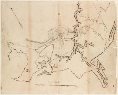
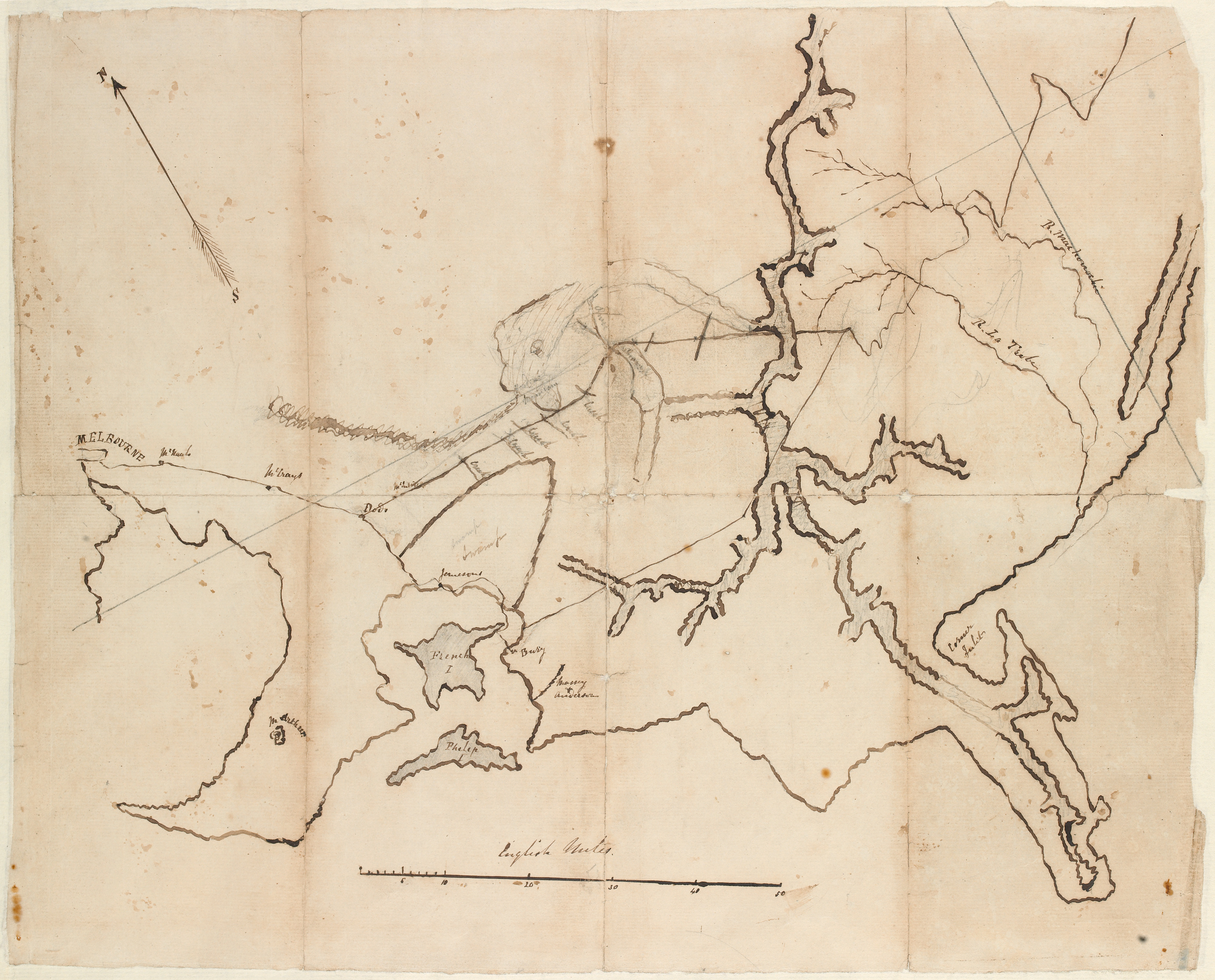
Map drawn by Count Paul Strzlecki during his 1840 exploration of Gippsland.
Count Paul Strzlecki, 1840. Hand-drawn map.
Accession number: MS 9853
From the State Library of Victoria's Manuscripts Collection.
See the catalogue record for this item

