Plan of the Port Phillip District
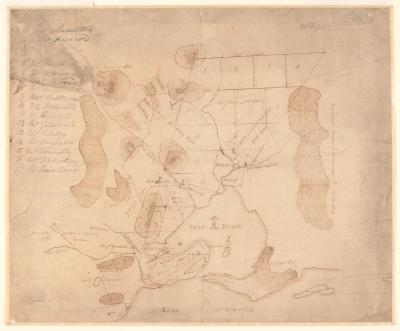
This map shows the proposed division of 600,000 acres of land, including the sites of Melbourne and Geelong, among members of the Port Phillip Association as a consequence of the treaties negotiated by John Batman with the Aboriginal people of the area in June 1835.
John Helder Wedge, 1835
Accession number: MS13487
From the State Library of Victoria's Manuscripts collection.

