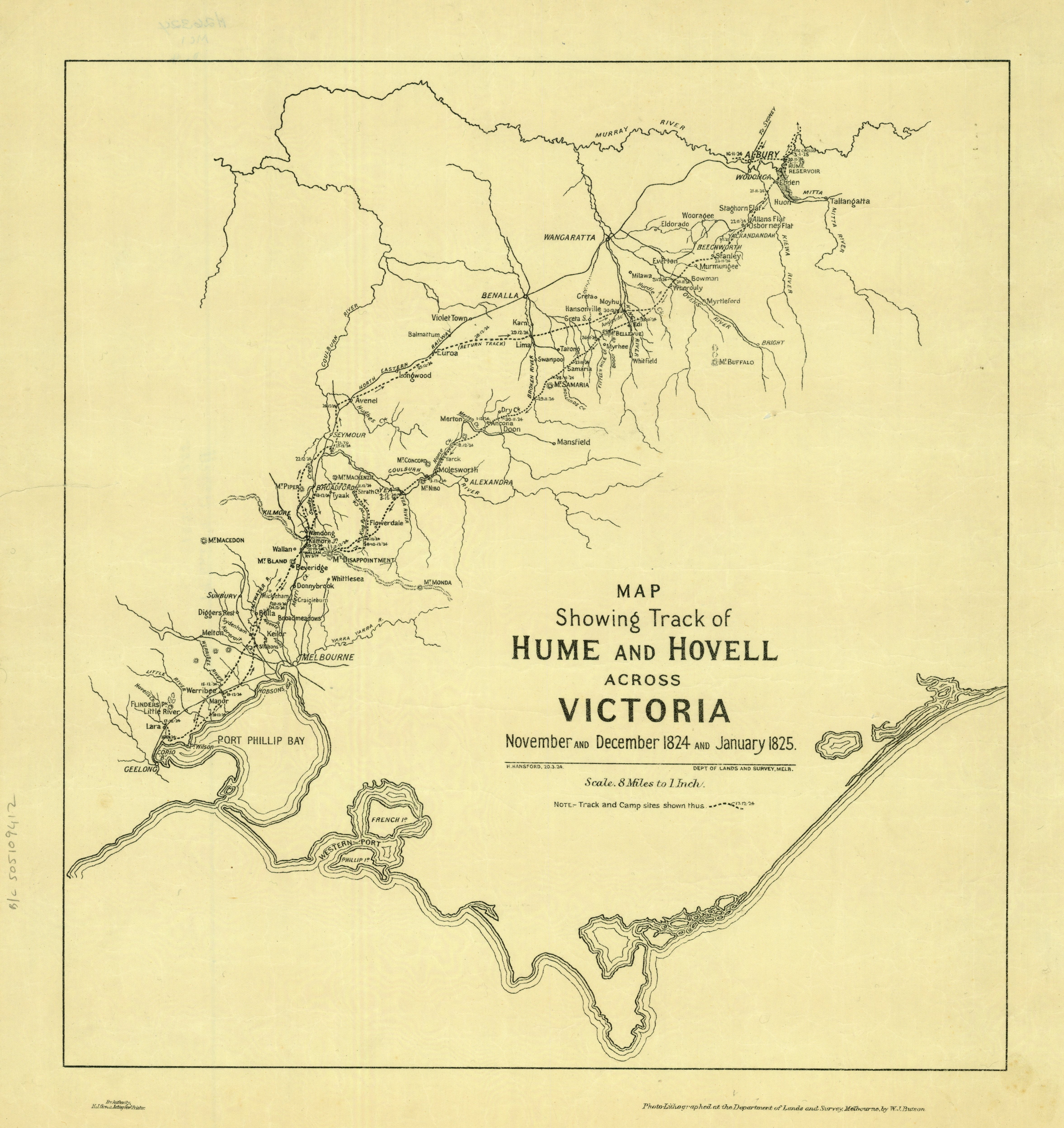
Map showing track of Hume and Hovell across Victoria
Hume and Hovell believed their explorations had led them to the western shores of Westernport, but their calculations were wrong and they were actually 100km off course, at a place known by the indigenous people as Corayo (Corio) on a bay called Jillong (Geelong). The pair returned to N.S.W with reports to Governor Brisbane of excellent grazing lands. It was not until 5 months later when Hovell returned to Westernport by boat, to find unfamiliar country, that he realised his lattitudinal mistake.
Department of Lands and Survey, Melbourne, c.1924, map.
Accession number: MAPS 820.5 AT 1824-1825
From the State Library of Victoria's Maps collection.

